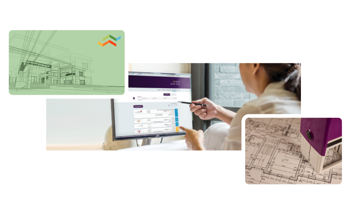
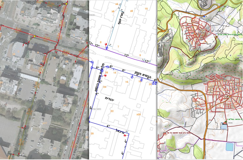
מערכת גיאומינד React4G מתאימה במיוחד למשרדים ממשלתיים רשויות ותאגידים הנדסיים שזקוקים ליישום פתרונות מיפוי אינטרקטיביים באתרי האינטרנט או ברשתות הפנימיות שלהם, תוך ניצול יכולותיו של טכנולוגיות מיקום לניהול ולהצגת נתנוים מרחביים
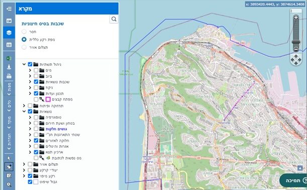
גיאומינד React4G
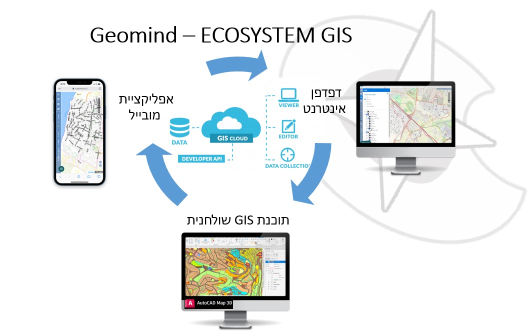
אפליקציית מיפוי אינטרנטית בטכנולוגייה מתקדמת. התוכנה עוצבה להתממשק עם שרתי קוד-פתוח מסוג MapServer, GeoServer, או שרתי GIS מסחרים אחרים, ומסקפת כלים ליצירה, צפייה ואינטרקציה עם נתונים גיאוגרפיים ומיפוי

תוכנה בטכנולוגיית React, להקמה מהירה של ממשקים, וחווית שימוש מתקדמת ודינמית.
תכונות עיקריות של גיאומינד React4G:
Key features of Geomind React4G include:
קוד פתוח: הפרויקט מסוג קוד פתוח, זמין לכל מי שמעוניין, ואינו מותנה ברכישת רשיונות.
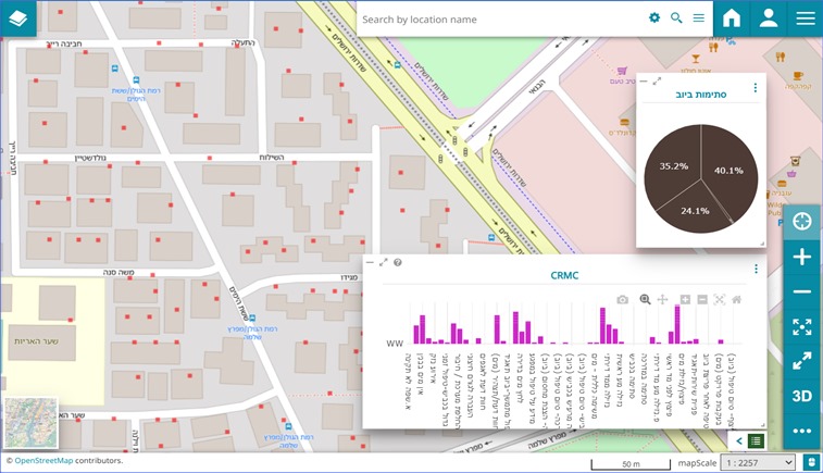
עשיר בתכונות: מציע מגוון רחב של פונקציונליות כגון שליטה בשכבות, הצגת נכסים, בחירת ישויות, ניווט במפה ועוד, שהם חיוניים למערכות מידע גאוגרפיות (GIS).
התאמה אישית והרחבה: מנגנון הרחבה של שכבות ומיידעים לפי הצרכים של המשתמשים.
ממשק זה מתאים במיוחד לארגונים שזקוקים ליישום פתרונות מיפוי אינטראקטיביים באתרי האינטרנט או ברשתות הפנימיות שלהם, לניהול ולהצגת נתונים מרחביים.

ניהול מידע תכנוני
כלים מתקדמים לניהול וקידום תהליכי תכנון, ייעודים ושימושי קרקע. כולל עדכונים בזמן אמת לצד מידע הסטורי והפקת דף מידע אודות זכויות בניה במגרש
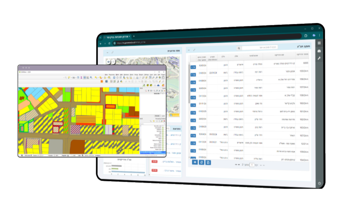
ארכיון תב"ע ויעודי קרקע
קידום הליך תכנון תבעו"ת והכלים לניתוח מגרשים ותצוגה ויזואלית של יעודי קרקע וזכויות בניה.
אנחנו נספק לכם את האמצעים לזיהוי אתגרים וקידום פתרונות יעילים, לתמיכה בקבלת החלטות ושקיפות ציבורית
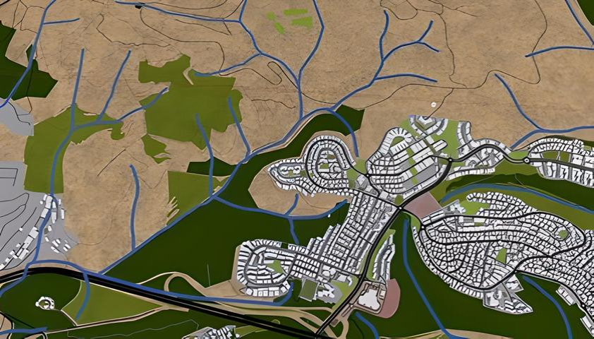
ניהול תשתיות הנדסיות
תמיכה בתהליכי מיפוי מדויק, ניתוח וניהול של תשתיות הנדסיות. סט של כלים לזיהוי מהיר של בעיות, תכנון תחזוקה אפקטיבית, והקצאת משאבים נכונה. הקצאת מודלים לניהול ופיקוח על פרויקטים, לשיפור התגובה למקרי תקלות מוקד וסיוע בבשיטוף מידע בין המעורבים בארגון ומחוצה לו.
תפעול ותחזוקה
תמיכה במעקב, ניהול וניתוח מדויק של תשתיות קיימות. הספקת תשתיות וכלים לתכנון תחזוקה, זיהוי בעיות ופתרונן בזמן אמת, וכן לקבלת החלטות מבוססות נתוני מיקום לשיפור ותמיכה בתיאום עבודות ופעולות, מקצר זמני תגובה לאירועים ומגביר את יעילות התפעול והאחזקה.

הנדסה תכנון ורישוי
מיפוי וניתוח נתונים גאוגרפיים לצרכי תכנון תשתיות מותאם לצרכים עירוניים. לצרכי איתור ותיעוד אתרים לפרויקטים, ניהול משאבים ותחזית השפעות סביבתיות, לסיוע באופטימיזציה של תוכניות תחבורה, פיתוח עירוני ותהליכי עבודה, לשיפור איכות המידע וקבלת החלטות מושכלות בתכנון העירוני.
הודעות Whatsapp
מנגנון תזכורות אוטומטי לתזכורות בדוא"ל, SMS או בווטסאפ.
ניהול פרויקטים
לניהול פרויקטים: מיפוי, ניתוח נתונים, תכנון וניהול תחומי, איתור משאבים, יישום תכניות וניטור פעולות

פיתוח מערכות BIM לתחומי הנדסה, בנייה ותשתיות
פיתוח מערכות BIM לתחומי הנדסה, בנייה ותשתיות מתמקד בשילוב בין מערכות מידע גיאוגרפי (GIS) לבין Building Information Modeling (BIM), מספק פתרונות מתקדמים לניהול ולתכנון של פרויקטים מרובי תחום. הפיתוח כולל יישום מתקדם של טכנולוגיות GIS ו-BIM, יצירת ממשקים משולבים ופתרונות אוטומטיים לניהול נתונים ולתהליכי עבודה. המערכות המפותחות מקלות על תהליכי קבלת החלטות, משפרות את תפקודי הפרויקט ומקדמות יעילות בניהול ובבנייה.

הדרכות
שירותי הדרכה לחברת GIS בקוד פתוח מתמקדים בהעברת מיומנויות בפיתוח ושימוש בכלים גיאוגרפיים ותוכנות פתוחות. הדרכה מקיפה כוללת לימוד תיאוריה, תרגול פרקטי, ויישום מעשי בפרויקטים ריאלים. נושאים כוללים שימוש ב- GIS, תכנון ובניית מפות, ניתוח נתונים גיאוגרפיים, ופיתוח יישומים מותאמים אישית. הדרכה מתאימה למתקדמים ולמתחילים כאחד, מספקת כלים להתפתחות מקצועית בתחום ה- GIS ומקדמת שימוש פתוח וחופשי בידע גיאוגרפי.
הטמעת טכנולוגיות בקוד פתוח והדרכה
שירותי הטמעת טכנולוגיות בקוד פתוח והדרכה לחברת GIS מציעים יישומים מתקדמים של כלים גיאוגרפיים ותוכנות פתוחות בתעשיית ה-GIS. השירותים כוללים הטמעה מקצועית ואישית של פתרונות טכנולוגיים, תהליכי פיתוח מותאמים לצרכי הארגון והדרכה מקיפה בשימוש בכלים ובתהליכים. המטרה היא לשפר את היכולות הטכנולוגיות של הצוות, לשפר את יעילות התהליכים וליצור פתרונות מתקדמים ומותאמים לצרכי העסקיים של הלקוח.
אפיון ופיתוח מערכות ומסדי נתונים מותאם לצרכי לקוח
שירותי האפיון והפיתוח של מערכות ומסדי נתונים מותאמים ללקוח מציעים פתרונות מותאמים אישית לצרכיו המיוחדים. בשיתוף פעולה עם הלקוח, אנו מזהה ומפרטים את הדרישות הדיגיטליות והתשתיות הנדרשות, ומעבירים את הרעיונות למעשה באמצעות פיתוח מערכות מתקדמות ומסדי נתונים מתואמים. השירות כולל אפיון מדויק, תכנון ויישום, ובסופו מספק מענה מקצועי ומותאם לאורך תהליך הפיתוח. תוצר הוא מערכות פונקציונליות ויעילות המשפרות את תהליכי העבודה ומקדמות את ההצלחה של הלקוח בתחום ה-GIS.


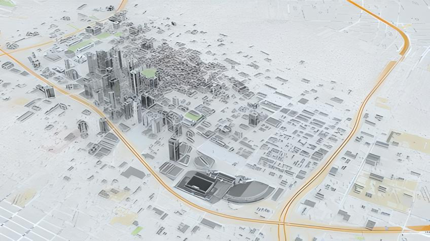
בניית מודלים 3D
החברה מפתחת מודלים 3D מתקדמים ב-GIS לניתוח והצגה באינטרנט. המודלים משלבים מידע גיאוגרפי עם מידע תלת ממדי, מספקים תמונה מקיפה וריאליסטית של הנתונים הגיאוגרפיים. הם מאפשרים ניתוח עמוק של הנתונים והצגתם באופן ברור וידוע לציבור הרחב. עם זאת, המערכות גם מספקות פלטפורמה מתקדמת לשיתוף נתונים באינטרנט, מאפשרת גישה נוחה ושיתוף מידע בזמן אמת, ומסייעת לצוותים לפעול ביחד באופן יעיל ומסודר.
- שירותי בקרה וקליטה של קבצי מדידה ממקורות ופורמטים שונים
- פיתוח מערכות BIM לתחומי הנדסה, בנייה ותשתיות
- בניית מודלים 3D
שירותי בקרה וקליטה של קבצי מדידה ממקורות ופורמטים שונים
שירותי הבקרה והקליטה של קבצי מדידה מקורות ופורמטים שונים מתמקדים באיכות ובדיוק הנתונים הגיאוגרפיים. באמצעות טכנולוגיות מתקדמות וכלים מתקדמים, אנו מתעסקים בקליטה, בבקרה ובאיכות הנתונים המגיעים ממקורות שונים. זה כולל המרה, סינון, וניתוח של קבצים בפורמטים שונים כמו SHP, DWG ועוד. השירות מספק פתרונות מותאמים, מקצועיים ומהימנים המקלים על הפרויקטים הגיאוגרפיים ומסייעים ללקוח לנהל נתונים מורכבים בצורה יעילה ויעילה.
פיתוח מערכות BIM לתחומי הנדסה, בנייה ותשתיות
פיתוח מערכות BIM לתחומי הנדסה, בנייה ותשתיות מתמקד בשילוב בין מערכות מידע גיאוגרפי (GIS) לבין Building Information Modeling (BIM), מספק פתרונות מתקדמים לניהול ולתכנון של פרויקטים מרובי תחום. הפיתוח כולל יישום מתקדם של טכנולוגיות GIS ו-BIM, יצירת ממשקים משולבים ופתרונות אוטומטיים לניהול נתונים ולתהליכי עבודה. המערכות המפותחות מקלות על תהליכי קבלת החלטות, משפרות את תפקודי הפרויקט ומקדמות יעילות בניהול ובבנייה.
בניית מודלים 3D
החברה מפתחת מודלים 3D מתקדמים ב-GIS לניתוח והצגה באינטרנט. המודלים משלבים מידע גיאוגרפי עם מידע תלת ממדי, מספקים תמונה מקיפה וריאליסטית של הנתונים הגיאוגרפיים. הם מאפשרים ניתוח עמוק של הנתונים והצגתם באופן ברור וידוע לציבור הרחב. עם זאת, המערכות גם מספקות פלטפורמה מתקדמת לשיתוף נתונים באינטרנט, מאפשרת גישה נוחה ושיתוף מידע בזמן אמת, ומסייעת לצוותים לפעול ביחד באופן יעיל ומסודר.
תוכנת GIS לניהול תשתיות מים וביוב:
בקרה וקליטה אוטומטית של קבצי מדידה, שמירה על עדכניות המידע בסטנדרט הנדסי. אין צורך בהתמרה והסבה של מידע, ייבוא/יצוא מודלים ייעודיים לתאגידי מים כגון 'מגוף שולט', אחזקה, פרויקטים ויומני עבודה, אפליקציית מובייל לאיחזור וביצוע סקרים, עצמאות מלאה בתפעול מערכת ליצירת שכבות ועדכונם. הפקת מפות, דוחות, ביצוע שאילתות ועוד
